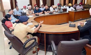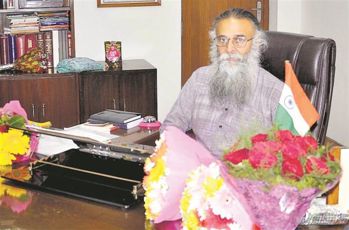
Not at sea: Survey ships are not fighter ships and do not carry fire arms. Photographs courtesy National Hydrographic Office, Dehradun
Hugh Gantzer
Ships crossing the enigmatic waters of the Indian Ocean Area depend on the precise, hi-tech, nautical maps of the ocean prepared by the specialists of the Naval Hydrographic Office, Dehradun. Which begs the question: “Why is such a blue-water, seafaring, activity based in land-locked, mountainous Uttarakhand?”
Because of history and the driving, genetic, desire of mankind to discover what lies over the mountain and on that beckoning distant shore. Christopher Columbus sailed through the forbidden Pillars of Hercules ignoring the belief that that was where the ocean poured off the globe. The aphorism ne plus ultra or “No more beyond”, was proved wrong by the emblem of an S negating the two pillars. It eventually forming the dollar sign: $. Even our own Indic tradition imposed loss of status on those who crossed the dreaded Black Water! But shibboleths have never stifled human endeavour. Since most of the globe is covered in oceans, humans were determined to cross them and draw charts to lead others to navigate this seemingly trackless expanse.
Indian navigators
In his superb book, Early Marine Charts of India, reputed cartographer Dr. S.P Sharma reproduced a Portuguese chart of the North Indian Ocean dating to 1519. It’s more a painting than the precise charts we use today. He describes such charts as having “Delicate lettering, elaborate cartouches and imaginative geography interspersed with facts”. Nevertheless, since this was made just 12 years after Vasco da Gama landed in Kerala, reputedly using an Indian navigator, it must have been a useful chart at that time.
For the sea-girt English, driven by the urgency of an over-populated island, such pictorial charts were not good enough. They had ousted the Dutch who had driven out the Portuguese and their East India Company had realised that more gains lay in acquiring real-estate than mere trade. When the traumatic events of 1857 gave them a good excuse to acquire the assets of the Company, they continued with the pragmatic business of making the sea routes safer to bring prosperity to their over-crowded misty isles. In 1779, Alexander Dalrymple, Fellow of the prestigious Royal Society, had been appointed the first Hydrographer to the Company. From then on the Company had extended its reach to the Persian Gulf, the Red Sea, the coast of Africa and Mesopotamia. Thus, when the EIC ceased to exist in 1873, and all their work was transferred to the Hydrographic Department of the Admiralty of the Royal Navy, the British inherited an established history of hydrography covering a large swathe of the Indian Ocean Region (IOR).
Seafaring knowledge
This great wealth of precise seafaring knowledge gradually became ours as independent India created its own cartographic experts in the Indian Navy.
Consequently, when the Naval Hydrographic Office — as it was then called — moved to Dehradun in 1954, because of its affinity to the Survey of India adjoining its campus, it acquired an unbroken tradition of more than two centuries of mapping the seemingly trackless oceans.
The amassing of such precise knowledge of the sea lanes is essential to our survival and growth. Many years ago, a perceptive naval officer, Commander Mihir Roy, wrote his far-seeing India and the Indian Ocean. Though his career advanced in the Service, his foresight was not recognised by those in control of our destiny. Our mindset is still obsessed with our land borders. We tend to forget that our coastline extends over 7,516 km and our Exclusive Economic Zone covers 2,01 million square km. Moreover, Navy Day is celebrated on December 4, because it was on that day that Naval Chief, Admiral SM Nanda, brought Pakistan to its knees by launching an audacious sea-based attack on Karachi using naval missile boats. Pakistan, too, had failed to secure its sea frontiers.
In their determinedly developmental role, the hydrographers of the Indian Navy continue to win friends and influence people across the Indian Ocean. When our survey ships work in the waters of friendly countries, they are not regarded with the apprehension that a combatant ship evokes. Survey ships are not fighting ships. By a convention respected internationally, they don’t carry armament suitable for a war at sea. Besides, during their survey duties they spend much longer in friendly ports than warships do. That is the nature of their work. Hydrographers, while on survey, leave their ships every morning, are out in the boats a little after dawn and move up and down their allotted segment of the survey area, meticulously recording their soundings.
Submarine topography
As the contours on topographical land maps show the varying heights of natural features, hydrographic charts indicate submarine topography. This is done by instruments that send a signal into the depths, receive echoes when they strike an obstruction, and then draw an image of what lies below. Closer to shore, this sounding is done by equipment carried in boats. Further away it relies on more powerful devices on board survey ships. I was on INS Jamuna when it was tracking back and forth across a Portuguese-held harbour in Goa. It had to make sure that there were no underwater hazards to endanger our fleet when it sailed in to liberate that alien enclave.
We saw the heavily armed Portuguese warship Afonso de Albuquerque closer to shore and thought its big guns would turn on us and blow our defenceless ship apart. But we had caught the Portuguese navy napping, quite literally. It was only when we had completed our job that I saw a man emerge on the upper deck of the Albuquerque, stretch, spot us and race down. Bells rang, sirens howled, but it was too late. Our fleet sailed in and sank the Portuguese ship. Nevertheless, it had been a close call for us.
‘String of pearls’ strategy
The Iberians had occupied Goa in the 18th century when many other European powers had carved out bases for themselves on our shores, threatening our sea lanes.
This must not happen again though the Chinese are trying to encircle us, with their String of Pearls strategy, using our neighbours. Countering them, with an absence of fanfare typical of the Silent Service, the hydrographers of our Navy worked undaunted to establish a very strong presence in the Indian Ocean. They have carried out extensive surveys in the region from Oman, Kenya, Mozambique on the east coast of Africa to Mauritius, Seychelles, Maldives and Sri Lanka. This Hydrographic engagement is likely to increase in the future and, hopefully, they will fulfil the Prime Minister’s eastern initiatives.
In keeping with India’s burgeoning reputation as an IT power to be reckoned with, survey boats carry heavy, tablet-sized, Satellite-based Augmentation Systems, to locate their readings with hi-tech precision. On their return to the ship after a day spent in their boats, the surveyors labour through the night, checking and cross-checking that the digital data fed into their ship-borne Central Computer is accurate. Only then is it loaded into the computer in Dehra’s Hydrographic office where it is again checked and rechecked. At one time, naval hydrographers sought the help of the Survey of India to produce their charts. Today they have their own Hydrographic Production Data Base, in Dehradun. It creates their paper charts and also their electronic navigation charts. Both are bought by the seafarers of the world thus constantly earning a handsome income for India. In fact, according to several studies made by the International Hydrographic Bureau in Monaco, the hub of global Hydrographic activities, the cost-to-benefit ratio of such surveys is about 1:10 for major maritime nations like India.
International clout
In fact, our stature in the eyes of the IHB is so high, that one of our officers, Commodore DC Kapoor, Chief Hydrographer to the Government of India, was elected a Director of the International Hydrographic Bureau in Monaco; another, Rear Admiral Frank Fraser, became the President of that prestigious organisation. In spite of these and other global achievements, we are losing our hard-earned international clout because, fairly recently, Indian hydrographers have been repeatedly denied permission to attend meetings of decisive committees of the IHB.
According to the rules of the Bureau, members who do not attend two successive meetings lose their place on the committee. According to a belief held by retired naval personnel, obstructive bureaucrats regard attendance at these essential meeting as junkets referring to them, slightingly, as “military tourism”! Possibly the same worthy will describe a spell on the Siachin Glacier as a Himalayan Holiday!
Chinese hydrographers have surveyed the South China Sea, which Beijing now claims as its own home waters. Sadly, our bureaucrats have deterred the high achievers of our hydrographic branch from asserting their points of view in the forums of the world. It’s about time we proclaimed our rights over the surveyed, strategic, reaches of our own home waters: the Indian Ocean. Why are we ignoring the clout of our Make in India tag?
The writer, a retired Commander of the Indian Navy, worked with Commodore DC Kapoor on INS Jamuna
Scanning the oceans
 The National Hydrographic Office, Dehradun Photographs courtesy National Hydrographic Office, Dehradun |
1954: Naval Hydrographic Office established in Dehradun
1958: Promulgation of Radio Navigational Warnings taken over by NHO Dehradun. Fortnightly notice to mariners commenced.
1964: INS Darshak was the first naval and survey ship to be built in India, and the first to carry a helicopter.
1965: Chief Hydrographer to the Indian Navy was rechristened Chief Hydrographer to the Government of India.
I972: Commodore DC Kapoor was elected Director International Hydrographic Bureau, Monaco
1980: The Hydrographic School recognised as the Regional Training Centre for the South-Asian region
1994: Surveys on contract for Indian private sector ports and projects.
1997: Naval Hydrographic Office renamed National Hydrographic Office
2004: Post-tsunami, seven hydrographic ships deployed for relief along our east coast, Sri Lanka and Indonesia.
2005: Assistance provided to Mauritius, Maldives and Seychelles to set up their hydrographic infrastructure.


