|
January 3-7
 |
|
Exploring space with ISRO and hi-tech
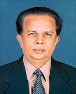
G. Madhavan Nair
Chairman, ISRO
|

G. Madhavan Nair
|
INDIAN
Space Research Organisation (ISRO) is a classic example to show how
government investment in promoting high technology research can result
in significant benefits that have social relevance. In the three
decades, since the Department of Space was established and ISRO brought
under this new department, the organisation has made remarkable progress
in research and development leading to the establishment of operational
state-of-art space systems like INSAT and IRS satellites along with
commensurate launch capabilities in a self-reliant manner. But more
important is the fact that these systems are used for various national
tasks. ISRO is also a case in point how an advanced technology programme
has to be orchestrated with a systematic graduation from experimental
programmes to operational systems that can form an important element of
the national infrastructure.
It was ISRO which
conducted the world’s largest sociological experiment, Satellite
Instructional Television Experiment (SITE) as early as 1975-76, when a
series of educational programmes on health, family planning, agriculture
and the like were telecast to over 2,500 Indian villages via the US
satellite, ATS-6. The Satellite Telecom-munication Experimental Project
(STEP), conducted using Franco-German Symphonie satellite during
1977-79, was another major demonstration of communication applications
of space.
These experiments paved
the way for the establishment of INSAT system in 1983. Today INSAT is
one of the world’s largest domestic communication satellite system
comprising seven satellites providing about 130 transponders in various
frequency bands besides meteorological instruments. It has heralded a
revolution in the telecommunications, television broadcasting,
meteorology and disaster warning services in India.
INSAT links several
hundred earth stations, including those located in inaccessible regions
and offshore islands in the country and several thousand Very Small
Aperture Terminals, VSATs. Television in India now covers about 65 per
cent of the Indian landmass and reaches about 80 per cent of its
population.
What is important is that
INSAT is not only used for the regular telecommunication and television
broadcast and meteorology but also for grassroots level development
through telecast of educational programmes and interactive training and
developmental education. It is used by many agencies and State
Governments to provide continuing education, conduct in-situ training
for industrial employees, social welfare personnel and training of
Panchayat Raj workers. An exclusive satellite, EDUSAT, for educational
use is planned for launch in 2004.
New applications of INSAT
connectivity are emerging. One such application is the tele-medicine
that makes specialised medical expertise available to people in remote
areas. So far 46 tele-medicine nodes have been set up connecting 34
rural and remote hospitals with 12 super specialty hospitals. These
include hospitals in Tripura. Leh in Jammu and Kashmir and Port Blair in
Andaman and Nicobar.
The INSATs, which also
carry meteorological instruments to provide meteorological data, have
vastly improved the meteorological services. The INSAT system is used to
track cyclone formations and their movements and issue warnings to the
affected population in the coastal zones through the cyclone warning
receivers.
In the use of space
technology for national resources survey, ISRO started with experimental
earth observation satellites, Bhaskara-1 and Bhaskara-2, launched in
June 1979 and November 1981 respectively. ISRO has now emerged on the
forefront by establishing and operating the world’s largest
constellation of remote sensing satellites. The IRS system provides data
in a variety of spatial resolutions and spectral bands. The most
advanced satellite in the series, RESOURCESAT-1, was launched by India’s
own PSLV in October 2003. ISRO has also launched an exclusive satellite,
OCEANSAT-1, for ocean resources survey and for studying the atmosphere
over the oceans. Another remote sensing satellite, Cartosat-1,
exclusively for mapping applications, is planned for launch in 2004-05.
The design and development of a Radar Imaging Satellite, RISAT, capable
of taking imageries both during night and day as well as in cloudy
conditions, is also under development. It can thus help in monitoring
agricultural crops and flood situations in spite of cloudy weather
conditions.
The data received from the
IRS satellites are used for monitoring and managing the nation’s
resources like production estimation of important crops, forest survey,
drought prediction, flood mapping and demarcation of flood-risk zones,
land use and land cover mapping for agro-climatic planning, waste land
mapping and classification, preparation of hydro-geo-morphological maps
for locating bore wells, marine resources survey, mineral prospecting,
monitoring of irrigation command areas, snow-cover and snow-melt run-off
estimation and so on. The data is also used in urban infrastructure
planning, alignment of roads and pipelines, detection of underground
fires in collieries, etc.
ISRO has achieved
self-reliance in launch vehicle technology too. Starting with a small
satellite launch vehicle, SLV-3, launched in 1980, ISRO has successfully
commissioned its Polar Satellite Launch Vehicle, PSLV, capable of
placing 1,000-1200 kg class satellite into 820 km polar sun-synchronous
orbit. It had so far seven consecutively successful flights
demonstrating its reliability. PSLV is now used for launching all Indian
remote-sensing satellites. It has also launched an exclusive satellite,
Kalpana-1, for meteorological services. A major milestone recently was
the second successful test flight of Geo-synchronous Satellite Launch
Vehicle, GSLV, in May 2003, which enabled its commissioning into
service. GSLV is designed to place 2,000-kg class communication
satellites into geo-stationary transfer orbit. The vehicle will pave the
way for launching India’s communication, broadcasting and
meteorological satellites in to the geo-stationary orbit. Also, the
development of a new version of GSLV to launch up to four tonne
satellite into Geo-synchronous Transfer Orbit has been taken up.
As an institution, ISRO
has acted as an important catalyst in the technological upgradation of
Indian industries by enlisting their participation in its programme. It
has transferred several technologies to industries for commercial
applications. A number of systems for remote sensing data processing,
communication earth stations and terminal equipment has opened up a
significant market for the industry. The space systems like the INSAT
and IRS have also triggered a large number of service sector
entrepreneurs in communication and broad casting systems and value added
services catering to remote sensing data users.
ISRO has a strong
interface with the academia, which has helped the space program to use
the research expertise available in research institutions and academia
in its space program. It has also triggered front ranking research in
these institutions.
While largely remaining as
an R&D institution, ISRO has enabled commercial benefits to accrue
to the nation through the commercial corporation, ANTRIX that has made
forays in international market. There are commercial agreements for
reception and marketing of data from Indian Remote Sensing satellites.
ISRO’s INSAT satellite capacity has been leased to International
customers. PSLV has so far launched four small satellites of other
countries on commercial terms.
Thus, there has been a
significant allround benefit to the nation and certainly the investment
that the government has made in an institution like ISRO has not gone in
vain.

|
