Tribune News Service
Chandigarh, April 14
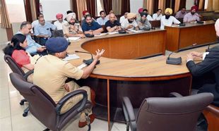
The two-day India-UK colloquium on remote sensing, air quality and climate change concluded at Panjab University (PU) here today.
The seminar was organised jointly by the Department of Environment Studies, PU, and Department of Community Medicine and School of Public Health, PGIMER, Chandigarh, in collaboration with the Department of Physics and Astronomy, University of Leicester, United Kingdom (UK).
In all, 10 talks were delivered in two sessions followed by open discussions. The colloquium aimed at assessing the science of space-based atmospheric measurements, greenhouse gases monitoring and management, with special focus on remote sensing-based satellite approaches.
The overview of satellite data in earth observation applications for a better understanding of earth’s landscape and climate were explained by UK-based and Indian experts, including Dr Harjinder Sembhi and Prof Hartmut Boesch from University of Leicester, Dr Ravindra Khaiwal from the PGIMER, and Dr Suman Mor from Panjab University.
Dr Sembhi highlighted, while combining expert knowledge in earth observation space sensors, highly accurate ground-based measurements with state-of-the-art models of the land surface to determine the climatic drivers and its relation to greenhouse gas emissions.
Dr Boesch stressed on the urgent need to increase the coverage of ground-based in-situ and remote-sensing networks to build more reliable models of the earth system used to forecast our future climate and to support the development of appropriate emission reduction strategies.
Dr Khaiwal from Department of Community Medicine and School of Public Health, PGIMER, stressed on mega cities, which, he said were like factories leading to emissions and better inventory using satellite data that can be used to lookout point emission sources like landfills etc.
Dr Mor emphasised on increasing agricultural production and industrialisation to meet the demands of growing population coupled with human-induced disturbances threaten the natural ecosystem in Indo-Gangetic region.
Over 45 participants from various institutions attended the colloquium and learnt to utilise large scale satellite datasets to manage environmental resources.
Most Read In 24 Hours
Don't Miss
View All


Top News

Phase-2 campaign ends, fate of Rahul Gandhi, Gajendra Shekhawat, HD Kumaraswamy, Hema Malini to be sealed
88 seats up for grabs across 13 states | Polling to conclude...