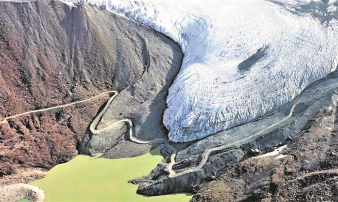
The new track between Sasoma and Saser La
Ajay Banerjee
Tribune News Service
New Delhi, August 19
India’s control over the vital Sub-Sector North (SSN) in Ladakh hinges upon a newly built 255-km DSDBO road, a mud-paved airfield at an altitude of 16,700 feet at Daulat Baig Oldie (DBO) and an upcoming track from Sasoma to Saser La to Murgo.
The Indian Army has, in the past, war-gamed a scenario about the People’s Liberation Army (PLA) China, making a westward thrust into 16,000 feet high 900 sq km area, the Depsang plains in the SSN.

On the Indian side, the PLA’s military objectives in SSN could be to threaten a section of the DSDBO (Darbuk-Shyok-DBO) road. It can attempt to cut off the DBO, which could, in turn, restrict access to Karakoram pass. The PLA could also make a bid to access the Saser La, a 17,800 feet high pass in the Karakoram mountains. This would further open a route to Sasoma and crucially the road to base camp of Siachen glacier.
For now, all such attempts by the PLA can be thwarted, explained an official. But India should not stop seeing these as long-term threats, he added. Also, it should include a scenario that PLA’s westward thrust could be timed with Pakistan army’s eastward push from across Gilgit-Baltistan in what could be a two-front war scenario for India.
The Indian defensive positions on SSN have been “built” to hold back the PLA with tanks, artillery guns and the latest systems, besides additional troops. Since May, some 8,000 troops are stationed by India in SSN to mirror the deployment of what the PLA has done.
Within the establishment, it’s known that holding onto SSN and particularly the Depsang plains is vital. For this, the DSDBO road is the crucial link. The new alignment Sasoma-Saser La-Murgo, as reported in The Tribune in its edition dated August 19, will take a while to be fully ready. For now, it’s a summer route. The 27-km walking track between Saser La and Saser Brangsa is the challenge.
In the past, consultations have been done with Swiss experts for tunnelling under Saser La. So far, the route can be used by troops. The supplies will have to come through DSDBO or get air-supplied at DBO or if needed, air-dropped at Chungtash, which is the dropping zone near Murgo, using the fleet of Chinook and Mi-17 helicopters.
Join Whatsapp Channel of The Tribune for latest updates.


