Picture for representational purpose only.
New Delhi, January 23
As Delhi witnessed partly clear sky on Tuesday, the temperature increased slightly, however it was still below normal.
‘Extreme’ jan Last recorded in 2012
The IMD records say Delhi on an average recorded 10 days of extreme weather conditions in January, five days each of cold days and cold waves. Last time such extreme weather conditions were recorded in Janaury 2012. While cold day refers to chilly weather conditions in the daytime, cold waves occur when night temperatures fall below 4°C.
The maximum and minimum temperatures were recorded at 19.5°C and 6.9°C, respectively, each a degree below normal. Chilly winds blew in the evening at a speed of four kmph from Southwest in the morning, Northwest during the day and Northeast directions in the evening, according to the Indian Institute of Tropical Meteorology (IITM).
In the morning, moderate fog was observed in some areas of Delhi with visibility of 200m, the weather agency said. The IMD has forecasted that temperatures will increase gradually with maximum reaching 20°C by January 28 while minimum temperature will be 8°C.
On Wednesday, maximum and minimum temperatures are predicted to be around 19°C and 7°C, respectively, with moderate fog in the morning.
Meanwhile, the air quality index (AQI) reading was recorded at 368, in the ‘very poor’ category. The average AQI reading was recorded at 333 yesterday. Among the nearby areas, Noida also entered the ‘very poor’ category with AQI at 311. Faridabad saw improvement in its air quality as AQI decreased from 333 on Monday to 277 on Wednesday.
The AQI spiked in some localities of Delhi where the AQI breached the 400 mark to enter the ‘severe’ category — Wazirpur (423), Jahangirpuri (415), Mundka (413), Narela (413) and Punjabi Bagh (405).

The Tribune News Service brings you the latest news, analysis and insights from the region, India and around the world. Follow the Tribune News Service for a wide-ranging coverage of events as they unfold, with perspective and clarity.
Join Whatsapp Channel of The Tribune for latest updates.
Most Read In 24 Hours
Don't Miss
View All


Top News

Swati Maliwal 'assault': Police collect evidence from Delhi CM's house, form teams to trace Kejriwal’s aide Bibhav Kumar
AAP MP Maliwal taken to CM’s house to recreate crime scene

Bibhav Kumar said ‘Neech aurat, tujhe sabak sikhayenge’, repeatedly slapped me, kicked me in the chest, pelvis while I had periods, alleges Swati Maliwal in FIR
The Rajya Sabha MP of the Aam Aadmi Party gives a graphic ac...

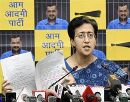
Swati Maliwal ‘assault’: AAP says BJP conspiring to frame Delhi CM Arvind Kejriwal, video exposes Maliwal 'lie'
In her FIR, AAP Rajya Sabha member Maliwal has said that she...

Congress candidate Kanhaiya Kumar assaulted while campaigning in Northeast Delhi
Incident happened outside AAP office in New Usmanpur area

ED files chargesheet against Delhi CM Kejriwal in excise policy case, names AAP as accused
Arvind Kejriwal is currently out of jail on interim bail