Sukhmeet Bhasin
Bathinda, October 28
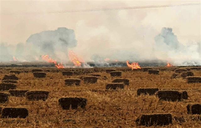
In a promising trend, Bathinda, Mansa and Moga districts have reported a drop in the number of stubble-burning incidents this year.
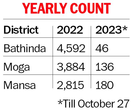
While only 180 farm fires have been reported in Mansa so far, Moga and Bathinda have reported 136 and 46 incidents, respectively. Of these, 45 farm fires were reported in Moga, 38 in Mansa and 18 in Bathinda on Friday.
Last year, Bathinda reported 4,592 cases of stubble-burning, Mansa witnessed 2,815 farm fires and Moga saw 3,884 cases.

However, experts have predicted that the incidents of stubble-burning in the region may see a sharp spike in the next few days as harvesting of kharif crops is expected to gain momentum in the south Malwa belt in the coming week. They attributed the decrease in the number of farm fires to delayed harvesting in the southern Malwa region.
Farmers say they acknowledge the adverse effects of burning crop residue, but have no viable alternative. Meanwhile, environmentalists demanded a strict ban on stubble-burning.
A farmer, Gurmeet Singh, said, “We can neither press paddy stubble deep into the earth as it is a costly proposition, nor can we afford costly farm machines to remove it.”
In a bid to tackle stubble-burning, the Bathinda administration had tied up with the industries in the district, which collect stubble from fields and use it as a raw material in their units. This has also helped reduce the number of farm fires, but the exact picture will be clear only at the end of the harvesting season.
The Punjab Pollution Control Board (PPCB) takes the help of satellite imaging for identification of sites where the stubble is set on fire. After getting the images of stubble-burning through the remote sensing technique, a team is sent to the spot to ascertain the area of the land on which the stubble has been set afire.
Through these satellite images, the PPCB receives coordinates of the site and sends a team to the spot for measuring the area since the amount of fine depends on the area. The site coordinates are also sent to the Revenue Department to ascertain ownership details.
The team then prepares a report and submits the same with the SDM office, from where it comes to the PPCB for taking further action.
Join Whatsapp Channel of The Tribune for latest updates.
#Agriculture #Environment #Farm Fires #Malwa #Mansa #Moga #Pollution


